)
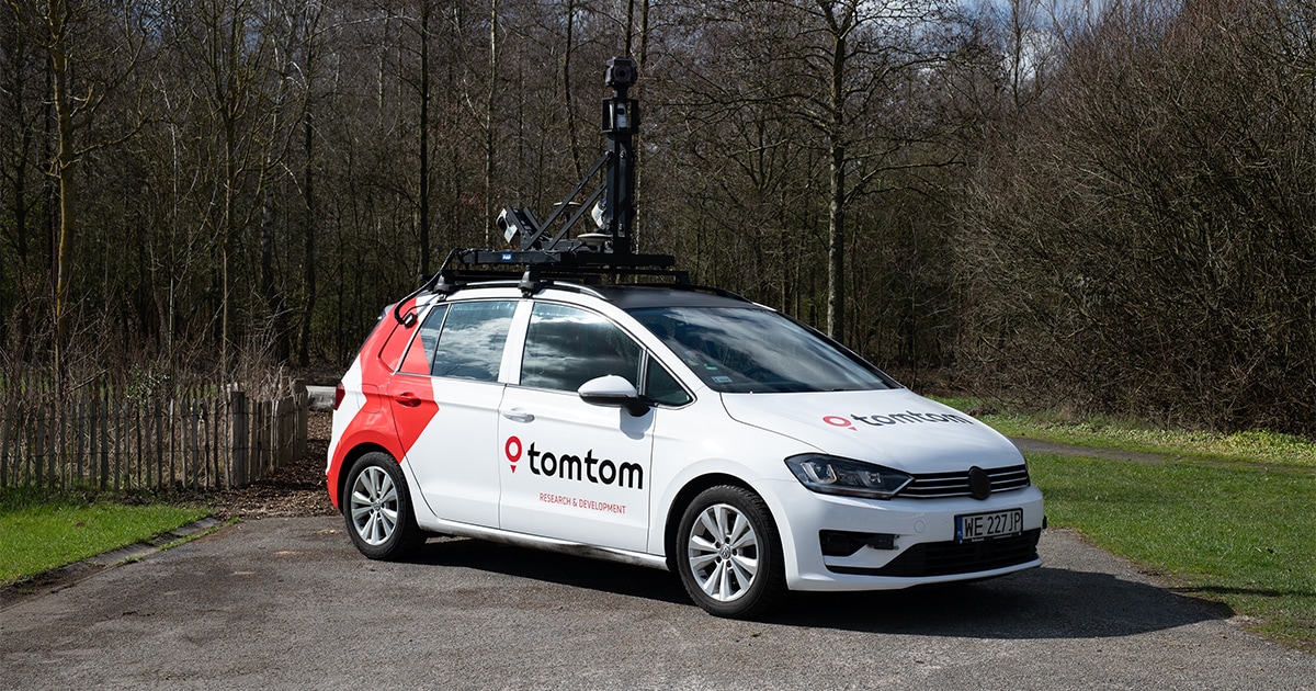
Maybe you’ve seen it yourself. Maybe it drove past you one day. Maybe you followed it on the highway during your commute. Whether you’ve seen it or not, it’s almost certainly driven on the same roads you drive on every day. The TomTom Cars, or more specifically, its mobile mapping (MoMa) vehicles have been nearly everywhere and have long been an important tool in TomTom’s mapmaking. But with mapmaking evolving and map data available from more sources, will we continue to see MoMa vehicles on our roads?
The short answer is yes. The long answer is that their role and their value to TomTom’s mapmaking is evolving.
Hervé Clauss, TomTom’s Director Maps Sensor Sourcing Technology and Bart Volckaert, TomTom’s Program Manager Maps, Sensor Sourcing Technology, both say that MoMa vehicles are just as important as ever, even if they are being used in slightly different ways and for different reasons.
A brief history of MoMa vehicles
In the early days of digital mapmaking, MoMa vehicles were the cornerstone of TomTom's location and geospatial data gathering.
Over the years, the TomTom Cars have driven the world’s roads, visiting the world’s most populous cities to rural villages. They drive past some of the world’s most inspiring landmarks, taking photographs, measuring distances and capturing geographical information about the world we live in.
People all over the world get excited when they spot one — just search for the hashtag #TomTomCar on Twitter/X and you’ll see just how far and wide these cars have travelled.
Today, MoMa cars still play a crucial role in mapping for TomTom, but they exist among many other data sources.
What’s happening to the TomTom Car?
At one point, TomTom operated handfuls of MoMa vehicles on every continent to ensure it had ample data sourcing. But today TomTom uses a vast array of sources, including open data, which has triggered a need to rethink how best to use MoMa cars.
The changes in mapmaking are being driven by data. Data that, in the early days of digital mapmaking, wasn’t as readily available as it is today. Geospatial data from sensor derived observations (SDO), open data and partner data, among others, is creating a wealth of opportunity for TomTom to keep its map as fresh as possible in new ways.
“We see an increasing trend in SDO, so we might ask why we need MoMa?” Volckaert says. “And we’re always analyzing our sources for how to make the best map.”
Indeed, with data on tap from powerful new super sources, why keep MoMa vehicles running?
“The easy answer is, as we dive into the coverage of SDO, we see it’s not yet on all road classes. The second answer is we don’t have [LiDAR] point clouds from SDO, which we need for accuracy purposes and HD mapping,” Volckaert adds.
[If you want to learn more about SDO, check out this article. But in short, SDOs are observations about the world gathered from sensors on regular vehicles — things like cars with cameras, GPS sensors for trace data, and so on, provide SDO data. SDO continuously generates huge amounts of data, very quickly and is helping TomTom map the world with greater freshness, accuracy, and detail.]
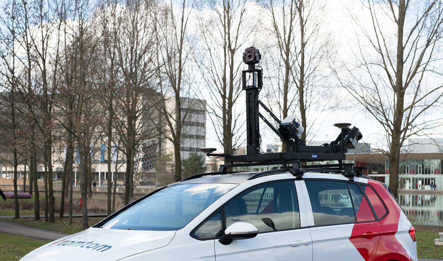 TomTom MoMa car sensor array. On the top of the TomTom Cars are 360 degree cameras and LiDAR sensors. They're also equipped with incredibly accurate GPS hardware to deliver centimeter accuracy.
What do TomTom Cars do now?
Data sources like SDO aren’t yet able to compete with MoMa cars when it comes to reliability and depth of detail. SDO is very good at keeping things like TomTom’s ISA tech up-to-date. And the value of thousands of cars driving past speed signs every day and reporting back what they see, or don't see, is sizeable.
MoMa vehicles are designed for purpose, they use highly calibrated telemetry and equipment, which makes the data they gather incredibly accurate and trustworthy.
“SDO is very useful, but it can’t do everything yet. There are some limitations,” Clauss explains. “Sometimes the subplates on street signs are too small for some cameras to read, so we don’t get input about those, but we do see that it’s there.”
The fact that SDO can identify changes, even if it can’t say exactly what the change is, is valuable in making maps. And it begins to demonstrate how the relationship between SDO and MoMa data as sources is evolving what MoMa is used for.
SDO is undoubtedly helping TomTom map the world with greater speed and accuracy, but sometimes, MoMa vehicles are needed to validate its findings. In many cases, SDO observations alert the company to a change in the world, which can be investigated further if required. That might involve sending a MoMa vehicle, equipped with 360-degree LiDAR and high-resolution cameras, to go and survey the area in incredible detail.
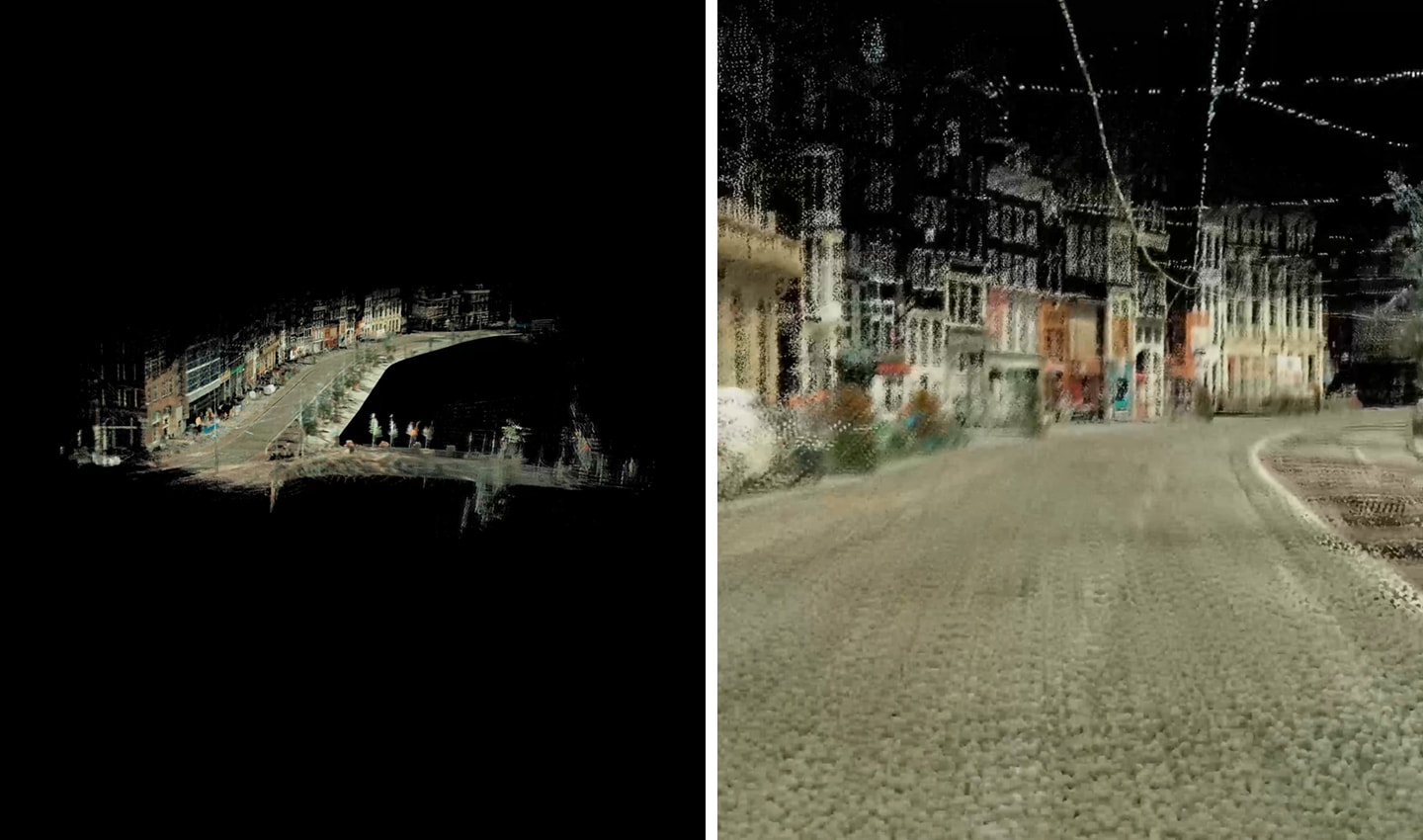 LiDAR 3D point cloud. LiDAR captures data as millions of individual points that can be constructured into a three dimensional image of the world.
As with other sources, SDO data points don’t always exactly match reality, Clauss explains. It’s not unusual that GPS traces be a few meters off reality and for observations extracted from images to be a little inconsistent. To resolve these issues, MoMa cars need to be used to validate and understand the tolerance of error between the observations and reality to establish something called ground truth. With a source of ground truth, it’s much easier to combine all the sources to create an incredibly detailed and accurate map.
Clauss says the MoMa cars are still the go-to device to confirm ground truth.
“We need ground truth to validate other use cases and validate the quality of other sources. We measure the accuracy of SDO observations with MoMa,” Clauss says.
What else do MoMa cars do?
There are some edge cases where MoMa is required, too. MoMa vehicles are very useful when it comes to specialist mapping needs that require very precise and specific data.
“Insurance companies use MoMa images to extract information about buildings and their attributes, so they can offer specific insurance packages based on the condition of the building. Road authorities use MoMa 3D point clouds and images to create and maintain road asset inventories,” Volckaert explains.
In these instances, no other sources can compete with what MoMa can provide.
MoMa’s ability to accurately and reliably map a given location and provide trustable data from just one pass is what sets it apart from other sources.
Where is the #TomTomCar going next?
People all around the world are always keen to know where the TomTom Car is going next so they can spot it out on the road, or even pose for it as it goes by — you all know what I’m talking about.
Historically, the goal of MoMa vehicles was to map as much as possible. If there was a road, TomTom wanted to drive down it.
“In the early days, these vehicles were out there discovering the world. Mapping roads that had never been digitally mapped before,” Volckaert explains.
Nowadays, TomTom already has a very detailed base-level understanding of the world, its road network, and its features. So, it can be more strategic about where it sends its MoMa vehicles.
“Today we tend to do what is called targeted driving,” Clauss says. “We go and drive in places based on knowledge of where changes are taking place and where we need more data.”
“Using SDO and other sources, we run change detection algorithms, and this gives us an indication of where we don’t have really good sources, and we need to know if something has changed. We need extra surveys, so we send our MoMa vehicle,” he adds.
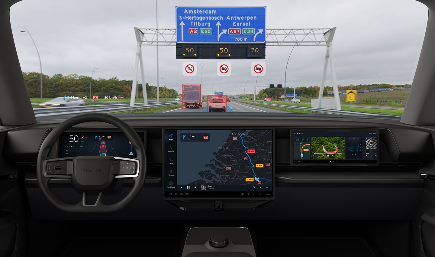 When cars drive past street signs their cameras can capture and interpret what that sign says. This information, or observation, is relayed back to TomTom. If lots of cars spot a change, it might be worth investigating further.
This process is helping TomTom be much more effective with where it sends its mapping vehicles. With SDO and other sources now bringing valuable map data and highlighting where changes are happening, MoMa cars can go straight to where they’re needed. In the end, this means TomTom obtains the data it needs more quickly and more efficiently.
A special relationship
On the surface, it might sound like some data sources are better than others and that would justify focusing on one data source over another to create some kind of hierarchy. But that’s missing the point.
Volckaert and Clauss are resolute in their belief that it’s not about replacing sources, but rather using all sources to their maximum. And to use all data sources in ways that complement each other.
MoMa on its own is great at capturing detail, but it comes with a price and gathering data through it takes time. SDO on its own can cover a lot of ground and provide a lot of insight about a lot of different places very quickly. But together, the value of the sources is unmatched.
In TomTom’s pursuit to keep its map as fresh as possible and map in real-time, the blend of SDO, MoMa, and other sources is creating a robust backbone on which to build its map. MoMa is a great source, and so is SDO, but together, they’re even better.
People also read
)
More than 20 years of mobile mapping, here’s how it began
)
Super sources will power the 'freshest map on the planet.' But what are they?
)
How maps can save connected cars from data outages
)
Navigation nightmare: How TomTom mapped an airport in three days
* Required field. By submitting your contact details to TomTom, you agree that we can contact you about marketing offers, newsletters, or to invite you to webinars and events. We could further personalize the content that you receive via cookies. You can unsubscribe at any time by the link included in our emails. Review our privacy policy. You can also browse our newsletter archive here.